WARM WEATHER UPDATE - TEMPERATURES LOOKS SET TO HIT AS HIGH AS 27C NEXT WEEK WITH A RETURN TO THUNDERSTORMS


7 days ago I posted a update regarding a possible warm spell at the end of June and again i updated again on this and now today the ECMWF model and GFS model show strong signals that this is going the be the outcome as we head into the weekend and next week where there will also be the risk of thunderstorms returning.
Continures below


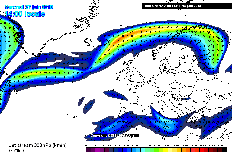
JET STREAM
When we look at the jet stream at present and where it is located it is right over Ireland and then over the weekend and the last week of June it moves northwards which would allow that warmer weather to develop. Attached below is the current jet stream position and where it looks set to be sitting during the last week of the month.
The jet stream looks set to move northwards and sit over Iceland and Scandinavia next week

Strong jet stream over Ireland at the moment which is bringing cooler conditions and unsettled weather

High pressure north of Ireland at the start of Ireland

Jet stream move northward on Friday with high pressure beginning to build over Ireland a Azores High
High pressure north of Ireland at the start of Ireland
Continues below

HIGH PRESSURE
Over the weekend and next week as high pressure builds and temperatures will rise into the high teen to low twenties and then into the mid twenties next week where temperatures of up to 27C is possible due to a Azores high building across Ireland
Below shows runs from both the ECMWF and GFS model today showing the exact same set up which is a very good sign to see both models in agreement at this stage.

ECMWF MODEL RUNS SHOWS HIGH PRESSURE OVER IRELAND NEXT WEEK

GFS MODEL RUNS SHOWS HIGH PRESSURE OVER IRELAND
THUNDERSTORMS
With that high pressure over Ireland next week near the end of the week we see a thundery low of the west coast of France and to the south of Ireland on both models which would mean the risk of thunderstorms returning later in the week but also remain very warm and sunny too.
Below I have attached a chart showing this thundery low can be seen on both charts as the orange circular area.


That's it for this update folks I will update on this possible spell of warmer conditions over the week and keep you updated with the latest happenings.
Kenneth from the Donegal Weather Channel.
If using any information of this article in the media feel free to do so as long as you CREDIT the Donegal Weather Channel using this link https://www.donegalweatherchannel.ie/