❄️ A RISK SNOW SHOWERS OF OVER HIGHER GROUND NEXT WEEKEND IRELAND & THE UK❄️
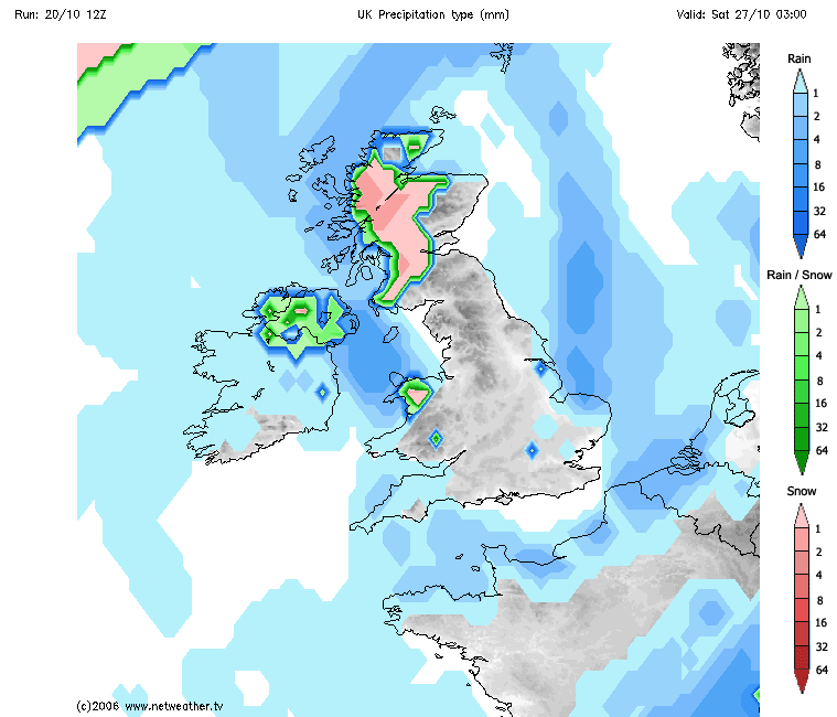
Risk of wintry showers next weekend currently showing on the latest GFS model
Later next week and next weekend a colder airmass is currently looking likely to affect Ireland and the UK with temperatures in single figures by day and below 0C by night.
A northerly airflow looks possible over the last few days of the month bringing with it much colder conditions across Ireland and the UK.
Higher portions of Ulster could see a few sleety snow showers with a covering of snow possible over the mountain tops especially across Donegal, Derry, Antrim, Sligo and Leitrim.
A few snow showers could be also possible across the southeast of Ireland across places like the wicklow mountains.
Night time currently looks as temperatures will drop as low as -3C in places with a hard frost and the risk of a few icy streaches on roads. Lower level areas will see a few sleet showers especially across the northern half of Ireland
Continues below
Meanwhile higher ground and some lower level areas will see the risk of a few snow showers which could give temporary coverings. With higher amounts of snow over the Scottish highlands. Temperatures across Scotland could drop to around -3C to -6C.
Wales at present also shows the risk of snowfall later next week into the weekend but mainly confined to higher ground.
Much of England looks dry with cooler day time temperatures than recent and frost for some areas at night.
I will provide another update during the week as I continue the monitor next weekends weather forecast. Much change to the forecast can still happen.
This is the first real signs since the end of march we have seen a more wintry patten establish. And with the NAO also set to go into a negative phase this also backs up what the weather models have been showing for a number of days


