A BAND OF HEAVY RAIN TO EFFECT PARTS OF IRELAND OVERNIGHT AND ON SATURDAY FROM HURRICANE LESLIE
The latest Satellite image showing Hurricane Leslie southwest of Portugal and storm callum northwest of Ireland
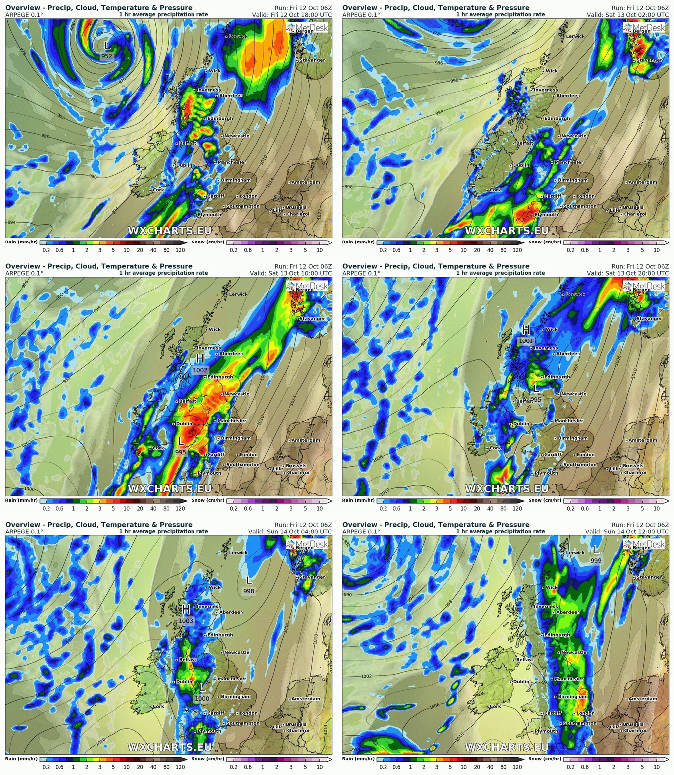
Later cloud will increase over much of the country apart from the far west of Ireland and the northwest where there will be some clear spells overnight. Light rain will begin to effect southern and southeastern areas before a spell of heavier rain moves in on Saturday morning leading to the risk of spot flooding across Munster and Leinster where heavy rain will become persistent.
Rain will spread to all areas over the day with some heavy bursts in places highest amounts across the east and south. On Saturday evening rain will clear southwestern and western parts of Ireland and then northwestern areas over night with clear conditions moving in from the west . It will be Sunday morning before rain clears the rest of Ireland and should clear everywhere at around 8am/9am. Sunday will be a good dry day everywhere apart from a few scattered showers in western and northwest parts. Over the day there will be nice Sunny spells everywhere. Winds will moderate at first across the country and southwesterly in direction but veer southerly over the later stages of the afternoon and be light. Temperature will range between 10C to 12C on Sunday and it will feel cool over the day, so if you have any plans for Sunday wrap up.
Above shows the rainfall moving up across Ireland over night and Saturday before clearing Saturday night into Sunday morning with brighter conditions spreading in from the west
The spell of rain which moves in later tonight and on Saturday is a band of rain stretching all the way from the west of the Canary Islands where Hurricane Leslie is currently situated. The band of rain extends the whole way northeastward as far Ireland and the UK.
This can be seen on the Satellite image below
Hurricane Leslie of the southwest of Portugal and west of the Canary Islands this afternoon with storm Callum visible to the northwest of Ireland. The band of rain and cloud from Hurricane Leslie can be seen on this stretching all the way as far as Ireland and the UK
Continues below
On the below image we can see Hurricane Leslie southwest of Portugal, Storm Callum northwest of Ireland and Tropical storm Nadine of the west coast of Africa this afternoon. The image below shows the air mass. colder air to the north and warm air to the south
At present Monday looks set to be another dry day across Ireland but there is a risk of a band of rain moving in from the Atlantic on Monday night but this may not arrive until Tuesday morning looking at the latest model runs.
At present Wednesday and Thursday looks set to be two more mainly dry days across Ireland before another spell of rain either move in from the west on Thursday evening or night again with dry conditions for Friday day. The overall trend of the end of next week is for much colder conditions with the possible risk of frost returning to the forecast. Next weekend there may be the risk of further rain but it is yet to early to say yet due to such a mobile pattern in the Atlantic at the moment.


