
A dry start to the new week but the risk of colder conditions returning at the end of the month with wintry showers

The powerful upper ridge of high pressure which is currently sitting over Ireland and the UK this week will remain in place over the start of the new week but will weaking slightly later Monday afternoon and evening with pressure today sitting at 1048hPa and dropping back to 1045hpa Monday.
Monday is set to be a dry day with a bright and sunny spells these best across Munster and Leinster with come cloudier conditions over the west and north.
The high pressure which sits over Ireland and the UK is centered across England today and will recenter its self southwest of Ireland on Tuesday which will lead to showers and drizzle across the west, northwest and north on Tuesday. But alot of dry weather around also.

Wednesday will see the area of high pressure center relocate to the west of Ireland with a cloudy day nationwide with some light rain or drizzle at times. Rainfall amounts will be very small with many also see rather dry conditions. Winds on Wednesday will be very light so this could also lead to some fog developing in parts.
The area of high pressure crumbles further on Thursday and Friday with Thursday again be a cloudy day with a few showers around.
Friday will be another cloudy day with some showers or drizzle across Ireland.
continues below
NEXT WEEKEND
Saturday will see a mixture of bright spells and cloudy periods best of any brighter weather will be across the south of Ireland with mainly cloudy conditions further north.
Sunday will be a cloudy day with further showers but a band of rain looks set to spread from the northwest Sunday night turning heavy across parts of the west and northwest as it spreads southeast.
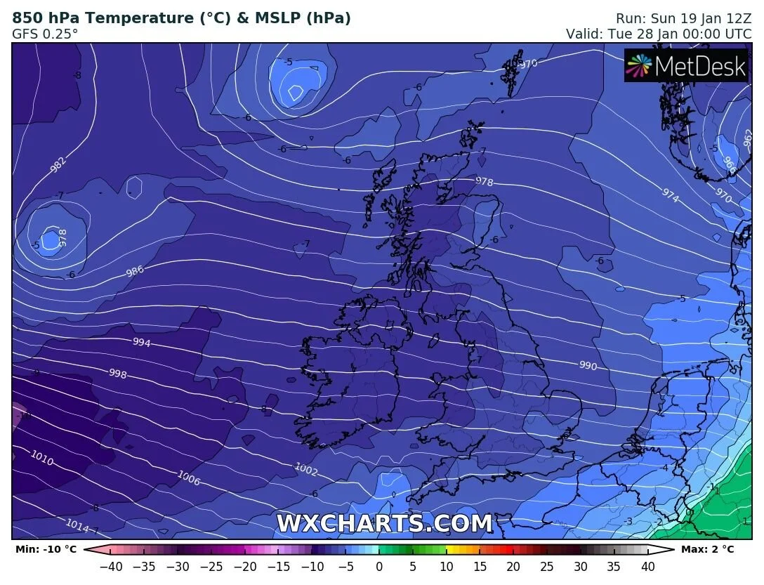
The last week of the month there are then signals that it will turn much colder across Ireland from around the 27th/28th onwards.
Current models runs from the ECMWF Model and GFS models suggest a colder period with wintry showers of hail, sleet and snow with a polar Maritime airmass but this is still some time away yet.
The latest models shows not real severe cold weather over the end of the month or the start of February.


Click on the tabs below to view the new forecasts available under the forecast section.
2019 CALENDAR NOW ON SALE


