Deadly Hurricane Ian, nearing Category 5 strength and set it have a devastating impact on Florida
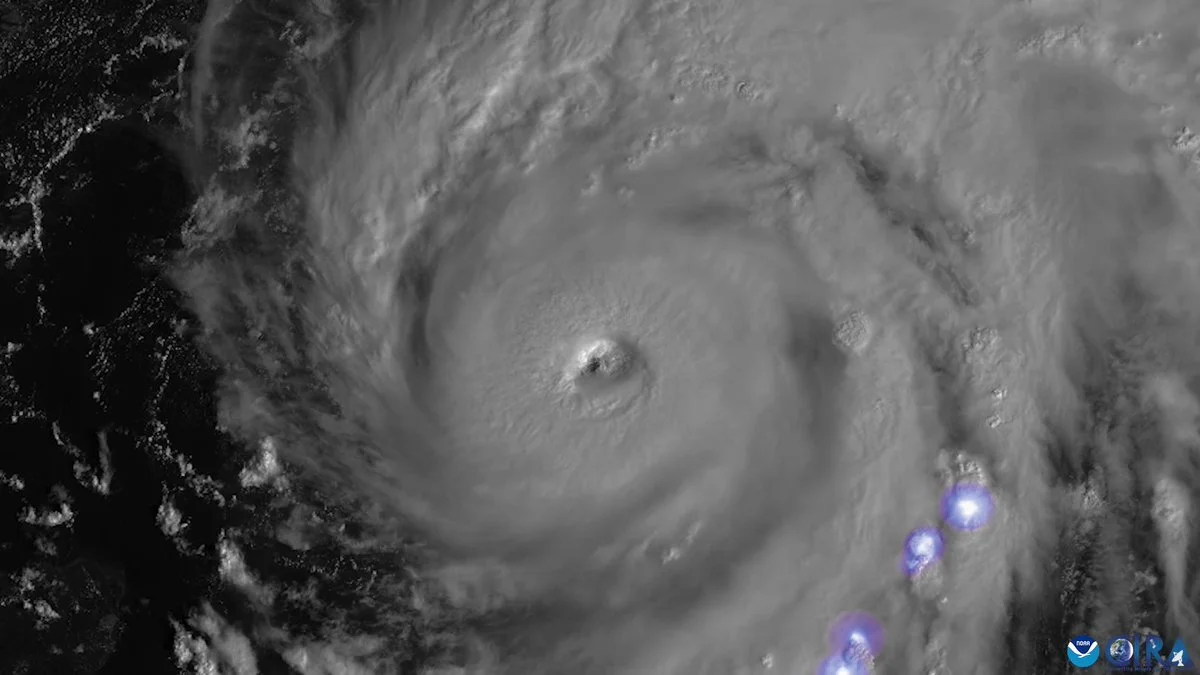
Hurricane Ian is seen as a powerful Category 3 storm in the Gulf of Mexico on Sept. 27, 2022 in this image from NOAA's GOES 16 satellite. (Image credit: NOAA)
Hurricane Ian – now an “extremely dangerous” storm just shy of Category 5 strength – is poised to inflict “catastrophic” winds and storm surge as it nears a Wednesday afternoon landfall in southwestern Florida, where it already is delivering ruinous winds and rain.
Now at Category 4 with sustained winds of 155 mph, Ian was about 60 miles west of Naples around 9 a.m. ET and its center is expected to cross onto land, perhaps north of Fort Myers near the Port Charlotte and Punta Gorda areas, by early Wednesday afternoon, the National Hurricane Center said.
And for those who didn’t heed evacuation orders along flood-prone coasts, a dire warning: In some places, it’s too late to get out, and people should “move to upper floors to escape rising water if necessary,” the National Weather Service said.
“It’s no longer possible to safely evacuate” from Collier County up to Sarasota County, Gov. Ron DeSantis said around 8 a.m., as key paths out, including the Skyway Bridge from Manatee to Pinellas counties, were closing.
“It’s time to hunker down and prepare for this storm,” he said. “This is a powerful storm that should be treated like you would treat” a tornado approaching your home.
After pummeling Cuba on Tuesday, leaving at least two dead and an islandwide blackout, Ian is taking aim at Florida’s vulnerable Gulf Coast, where residents have been boarding up and leaving in droves on congested highways. More than 2.5 million people were advised to flee, including 1.75 million under mandatory evacuation orders – no small ask in a state with a large elderly population, some of whom have to be moved from long-term care centers.
Ian poses several major dangers:
• Storm surge: Some 12 to 18 feet of ocean water pushed onto land is forecast Wednesday for the coastal Fort Myers area, from Englewood to Bonita Beach. Only slightly less (6 to 12 feet) is forecast in nearby areas, forecasters said.
Lower – but still life-threatening – surge is possible elsewhere, including north of Tampa and along Florida’s northeast coast near Jacksonville.
• Winds: Southwest Florida is faacing “catastrophic wind damage.” Winds near the core of Hurricane Ian could exceed 150 mph, with gusts up to 190 mph, the hurricane center said.
• Flooding rain: 12 to 24 inches of rain could fall in central and northeastern Florida – including Tampa, Orlando and Jacksonville. That makes for a top-of-scale risk for flooding rainfall across this area.
Up to 8 inches of rain is possible in South Florida as well as eastern Georgia and coastal South Carolina.
“Widespread, life-threatening catastrophic flash, urban, and river flooding is expected” across central and southern Florida, the hurricane center said.


