
Heavy rainfall & flooding for Ireland expected on Sunday night and Monday with weather warnings likely
Sunday night and Monday large amounts of rainfall look possible that could lead to flooding in places
After what will be nearly a week of settled and dry weather for most with good sunny spells it is dur to come to a end this Sunday with very heavy rainfall in the forecast for the early days of next week. Rainfall amounts have been well below the normal for this time of year, and accumulations in most areas have been less than half their average values

Over the course of next week rainfall amounts will be above average again with the highest amounts across the southwest, west and northwest with some areas set to see large amounts of rainfall on Sunday night and on Monday which will see some places see receive rainfall totals possibly of up to 50mm 80mm of rain which could see status yellow or even orange warnings issued for the time period.
Early warnings are likely to be issued as early as Saturday evening with a updated warning issued then for Sunday when details become more certain on the amounts of rainfall which are expected and where will receive the highest totals.


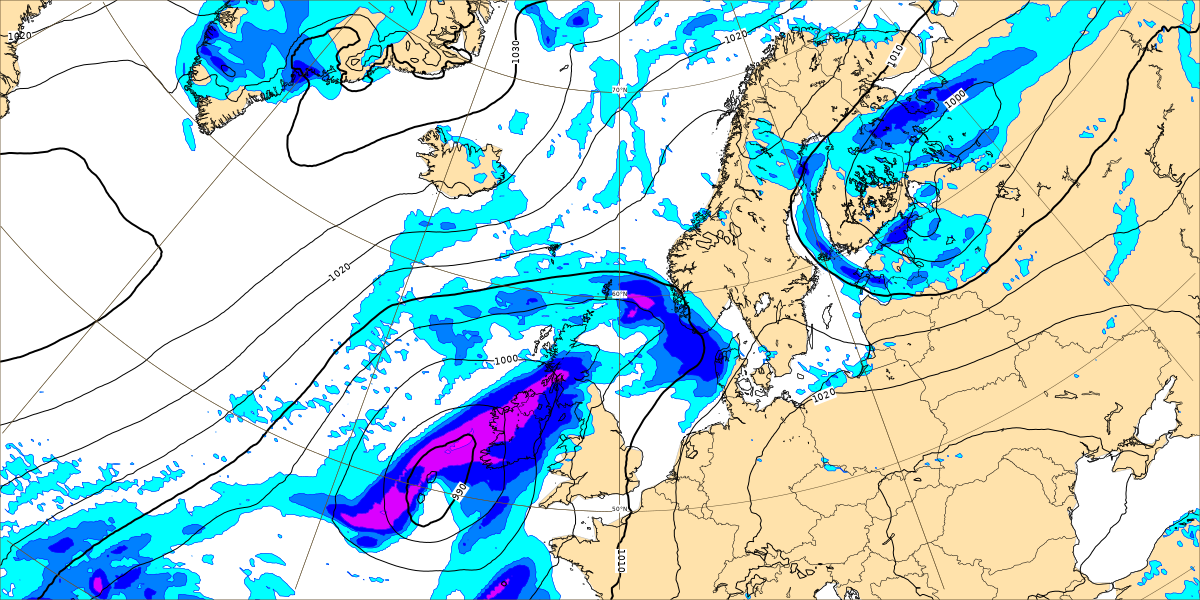
The heavy rainfall on Monday is associated with a area of low pressure which will move into the south of Ireland on Monday night that will move northwards on Tuesday morning bringing possible windy weather for places for a time on Tuesday. The impact level from wind at this stage will be low with only a few southern counties on the low level of the scale of coming under any wind warnings.
As mentioned the highest impact from the low pressure system will be the rain which will arrive ahead of the area of low pressure with the heaviest falls to the north flank of the low
7 DAY DETAILED FORECAST OUTLOOK
SATURDAY 17TH OCTOBER 2020
Dry for most areas on Saturday with some bright and sunny spells, some scattered showers possible across the south of Munster and south of Leinster. Temperatures will range between 11C to 14C.
Dry with clear spells overnight for many but some showers possible across south Munster.
SUNDAY 18TH OCTOBER 2020
Starting of dry for most areas with sunny spells on Sunday but cloud increasing later across the southwest some showers will effect coastal areas there later in the morning. The latest indication is for a band of rain then to move south to north across Ireland during the later afternoon, evening and night with some heavy falls in places especially across Connacht and Ulster with the risk of some spot flooding. Temperatures will range between 11C to 14C.
MONDAY 19TH OCTOBER 2020
Heavy rainfall will effect much of Ulster, Connacht and north Leinster early Monday morning with the risk of spot flooding. Later in the morning another spells of rain will move into the west extending nationwide across Ireland over the afternoon and evening with some very heavy falls in places especially across the west and northwest where some localised flooding may occur. Temperatures will range between 11C to 14C.
Further rain for many overnight with some heavy falls again especially across the west, northwest and north with the ongoing risk of flooding. It may turn windy overnight in places as a area of low pressure passes close or over Ireland.
TUESDAY 20TH OCTOBER 2020
Windy in places on Tuesday morning with the risk of some gales along coastal areas. There will be the risk of of further rain as a area of low pressure passing south to north across Ireland on Tuesday morning. The latest indication is for the area of low pressure to clear to the north of the afternoon with drier weather developing across the southern half of Ireland, Some further showers across the northwest and north at times during the afternoon and evening. Temperatures will range between 13C to 14C.
Dry and mainly cloud overnight for many parts but some showers will be possible across the northwest
WEDNESDAY 21ST OCTOBER 2020
The latest indication for Wednesday is for some further rain across the east and south of Ireland but drier across the west and north. Temperatures will range between 10C to 12C.
OUTLOOK
Remaining unsettled over the end of next week with the risk of further rain and windy weather at times. It possibly will also turn a little colder.
You can find all the latest weather warnings and forecasts by downloading our app from the google play store by clicking below

LATEST NEWS


