Risk of strong winds, heavy rain and a possible storm at the end of the weekend and early next week
Starting of with Saturday it will be a mostly cloudy day in all areas away from the southeast and east of Ireland some light rain and drizzle will occur across the west and north but there will be a lot of dry weather there too with any amounts of precipitation low.
Sunday will see some showers again these mainly across Atlantic coastal counties with the odd heavy burst possible in the west and northwest. Elsewhere will be mainly dry with some bright and sunny spells across the south and east.
Overnight Sunday a heavy spell of rainfall will move in from the Atlantic but at present the timing of this spell of rain shows it moving into western parts of Ireland between 3am and 5am moving eastwards across Ireland on Monday morning with the risk of spot flooding in places especially across the west and southwest of Ireland where at this stage a rainfall warning will be needed with amount showing of between 15mm to 30mm heaviest across higher ground.
The main band of rain then clears to the east over the Irish sea over early Monday afternoon with showers following behind for a time but clear and brighter weather extending from the west over the later afternoon and evening with sunny spells.
Late Sunday night and Monday morning wind will also increase with the strongest wind expect across the southwest, west and northwest particularly across coastal counties where wind could gust between 70km/hr to 100km/hr. This weather system is not expected to five any severe or damaging gusts.
continues below
As the weather front on Monday clears though another will be hot on its heels crossing the Atlantic and looks set to possibly effect Ireland on Tuesday and some weather models at this stage show hints it could give a bigger impact from winds but note when I say there is still some uncertainty on this system just yet.
Below we will have a look at this weather system and possible storm.
As i said above there is a lot of uncertainty on this system yet due to it been 4 days roughly around 90 hours to 102 hours away and a lot can happen between now and then.
The above chart I have attached shows Europe and the North Atlantic and is taken from the ECMWF model and it shows the size of the wind field on this storm with the center of the low pressure south of Iceland.
Above shows the same view of the same area of low pressure or storm but this image is from the latest GFS model run this evening which shows how close that wind field is to Ireland.
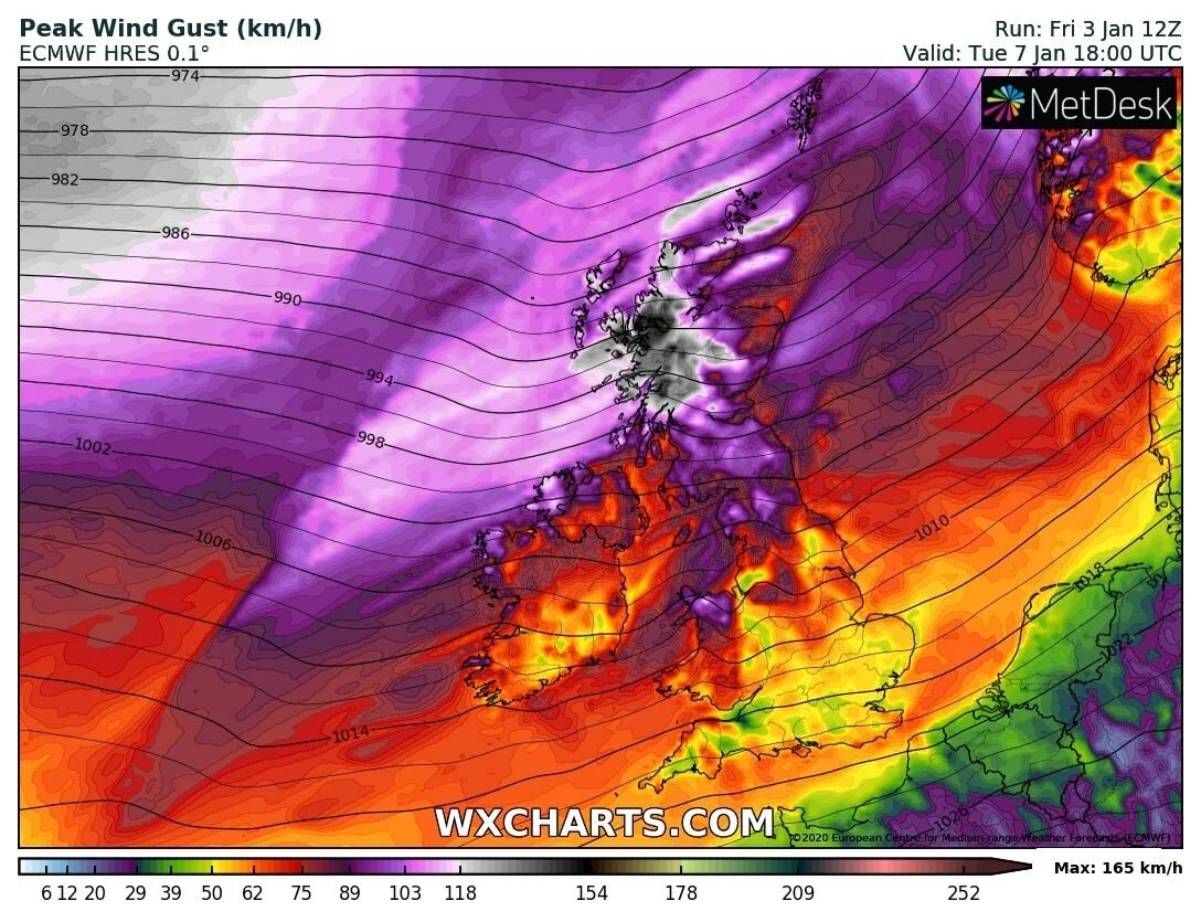
The above chart is from the ICON mode which shows severe and damaging gusts across the northwest particularly across Donegal but this chart tend to over cook things a bit and is only good to use closer to the time when comparing models.
At this stage there is no point me going into any more detail on this until closer to the time so around Sunday with the solution still shows on models.
continues below
The weather heading into the end of next week also look very unsettled with further heavy rain a times in places and the risk of some windy weather also at times.
Looking at the risk of colder weather in January i will have a post tonight on that.
Click on the tabs below to view the new forecasts available under the forecast section.
2019 CALENDAR NOW ON SALE


