WEATHER WATCH - RISK OF A STRONG WIND STORM HITTING IRELAND ON TUESDAY
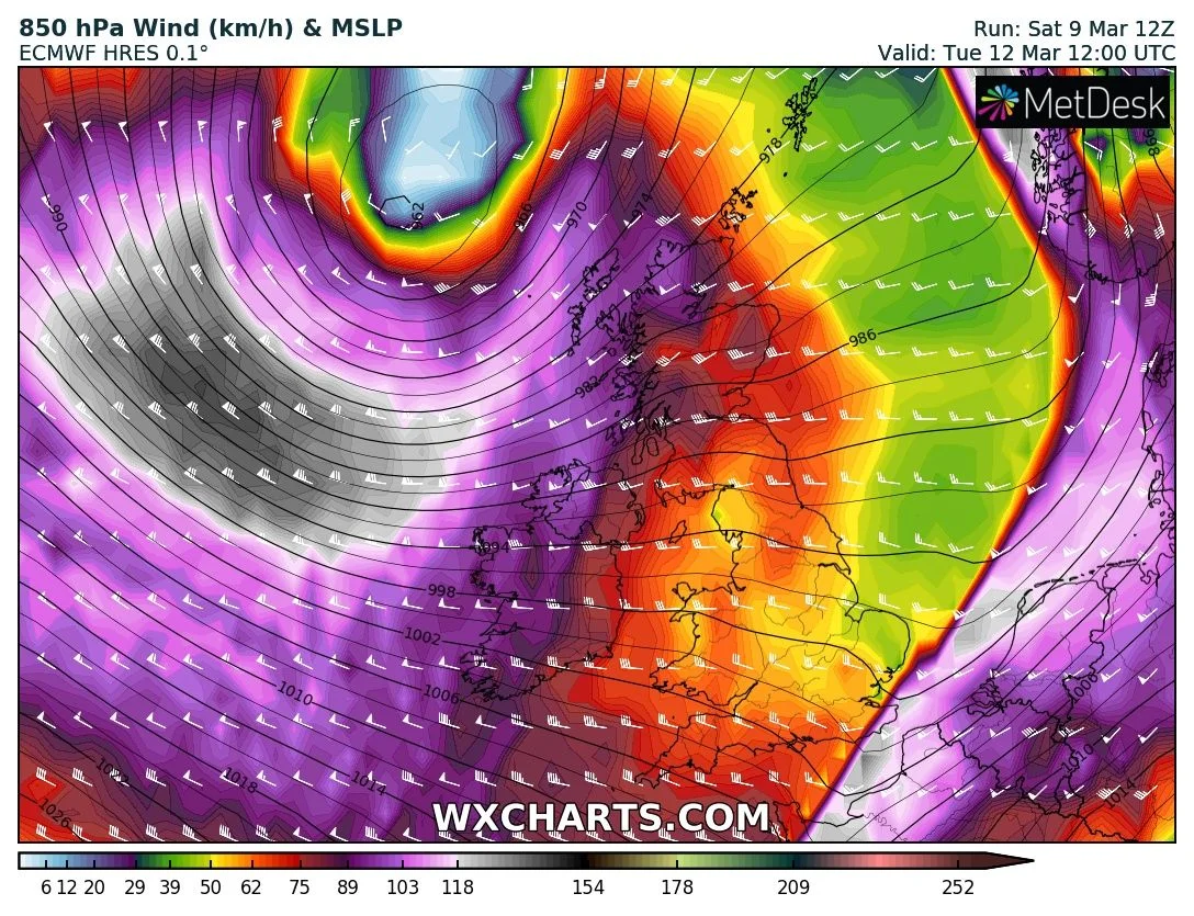
Next week the unsettled weather will continue across Ireland with very windy weather and the risk of a strong wind storm on Tuesday which is now showing up on all the models and show much the same pattern.
A very strong Jet Stream will help to push some vigorous and potentially disruptive Atlantic weather systems over Ireland early next week.
Between Saturday night into Wednesday there will be no let up with the adverse weather with thunderstorms, rain, hail, sleet, snow and strong and potentially damaging winds. At present there is a wind warning in place for Atlantic coastal counties with a nationwide snow and ice warning in place until Monday morning. The southwest, west, northwest and north will see the worst of the conditions.
Early this morning all ready there was some very active weather across Ulster and Connacht with some very active thunderstorm across the western half of Ireland and snow accumulations in Donegal, Tyrone, Derry and Fermanagh.
Continues below
On Tuesday evening a are of low pressure looks set to track close to the north of Ireland with very strong wind as it moves west to east over the UK with the potential of this storm to give severe and damaging wind gusts across Coastal areas of the west, northwest and north of Ireland of up to 140km/hr. Across the whole county there will be the risk of strong and damaging wind gust and could be a real problem later Tuesday into Wednesday morning. Warning are likely to be issued as early as Monday for this potential severe wind storm and may also be named. Winds from this storm would be west to northwest in direction .
Continues below
Along with strong winds very high seas and coastal flooding and damage would occur particularly across the west, northwest and north coasts of Ireland.
I will update on this again in the coming 24 hours to 48 hours due to the severe risk which is may bring.
Kenneth Mc Donagh from the Donegal Weather Channel
2019 CALENDAR NOW ON SALE


