
Further snowfall expected for places on Thursday with the risk of more windy weather this weekend
After what’s been a record week with 3 storms hitting the country winds have settled down this morning. This was the first time we have had 3 storms named in Ireland in the space of 1 week. Storm Dudley, Storm Eunice and storm Franklin.
Storm Franklin was the hardest hitting storm and was the one that got the least coverage but thankfully Donegal Weather Channel and other weather pages were able to raise the awareness with the public.
Some times storm get blowing out of proportion by media outlets. Best advice is to always take the advise from weather pages or Met Eireann. Parts of the northwest warrant a Red Warning last night with both Met Eireann weather stations at Finner and Malin Head recording red level winds warnings.
Thankfully last night everyone took the warnings issued by Donegal Weather Channel serious and nobody was hurt

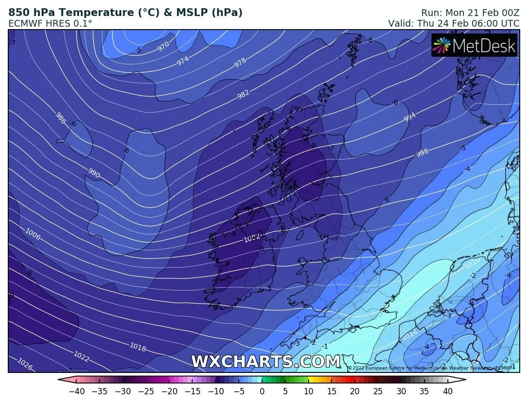
Its a new week and its another week of new weather. Wednesday night and on Thursday the weather is set to turn cold across Ireland again with heavy wintry showers expected of hail, sleet and snow.
The latest signals for Thursday morning are for rather cold upper air temperatures across the country epically across the west, northwest and north where the highest risk of some snowfall will be.

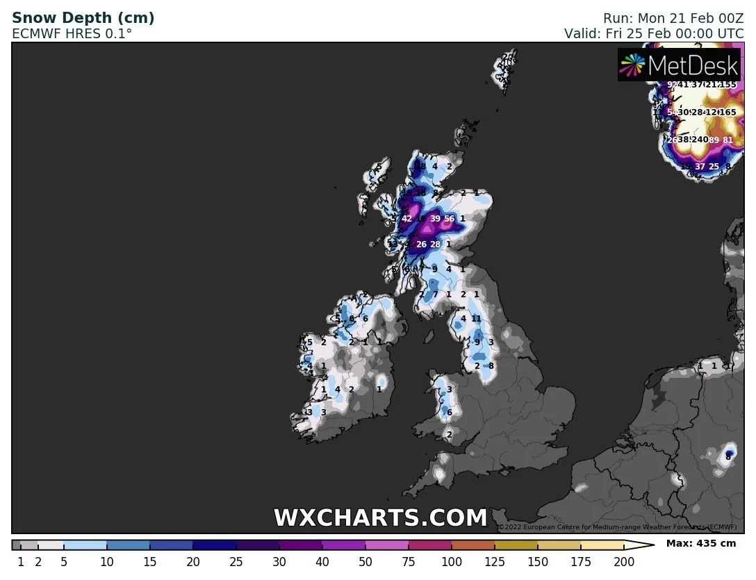
Heavy wintry showers will move in from the northwest turning increasingly to snow on Thursday morning especially in the northwest, west and north of Ireland with some snow accumulations possible. Some of these showers will also drift further inland into the eastern and southern half of Ireland.
Along with the risk of snowfall will come the risk of isolated thunderstorms with some big beefy convective showers also possible. The latest chart below show the risk of lying snow in some places especially across the west and northwest.
It will also be windy again on Thursday with low pressure passing to the north of Ireland. At present this low pressure system does not look as severe as storm Franklin but will five some gusts along Atlantic coastal areas of 100km/hr. This will be watched closely in case of any developments in the coming hours.
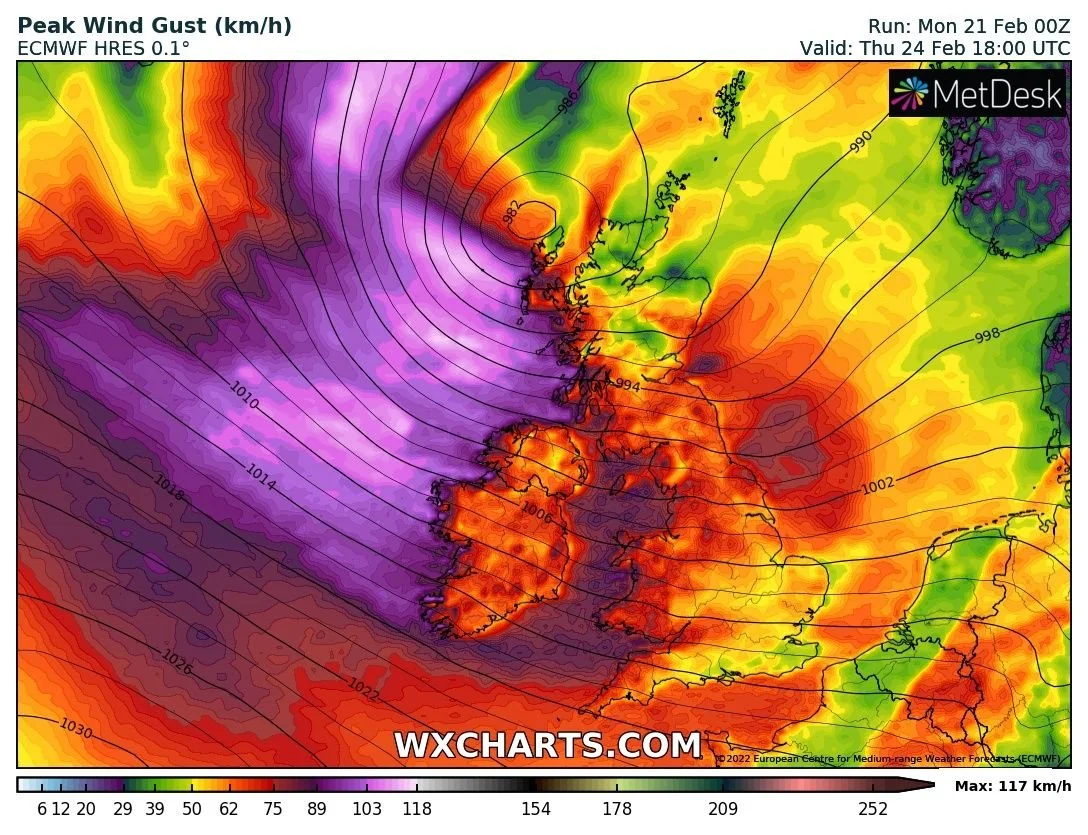
This weekend there are signs of some unsettled weather again with the risk of another strong low pressure system coming close to Ireland. Still some uncertainty on this yet but this will be closely watched for and changes and development over the week. The below ECMWF model shows and intense wind storm to the northwest of Ireland moving close to the west, northwest and north coast of Ireland at the end of next weekend


LATEST NEWS


