Ireland looks set to see much colder temperatures later next week with sleet & snow showers
Today's weather forecast models the GFS and ECMWF weather models are showing the first real signs of a temperatures dropping this side of the year with the possible risk of some wintry precipitation of sleet and snow.
Mid week next week a colder air mass looks set to push down from the north from the polar regions bringing much colder upper air temperatures across Ireland that could give icy and frosty nights with the coldest temperatures of the season so far.
The GFS and ECMWF shows colder upper air temperatures flooding in at the end of next week and weekend. This leaves the door open to a battle ground scenario which could lead to weather fronts with rain moving in from the Atlantic hitting the cold air turning to wintry precipitation of sleet or snow at times possibly next Friday or over next weekend.
Another outcome would be a northerly airflow leading to showers filtering into the northern half of Ireland giving some sleet, hail and snow showers mostly over Ulster with some wintry coverings across high ground areas and possibly lower levels at times.
The below image shows upper air temperatures across the northern half of Ireland at -5 to -6C this is the temperature approximately 1.5 km above sea level, usually just above the boundary layer.
850 hPa upper air temperatures approximately 1.5 km above sea level, usually just above the boundary layer.
The below image shows ground level or sea level air temperatures later next week with temperatures particularly across the northern half of Ireland down to 0C to -3C. So frost and icy conditions will be possible
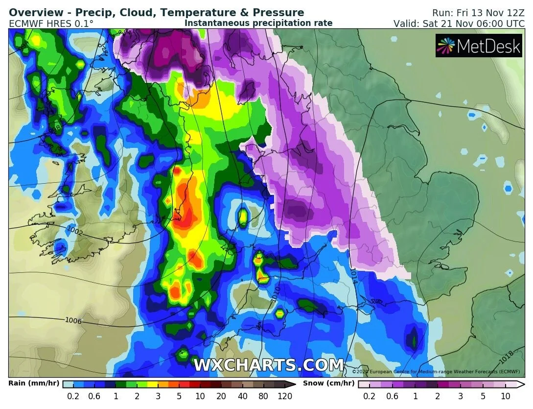
The Ecmwf model which i have attached below also shows a weather front moving in of the Atlantic later next week colliding with the colder air across the northern half of Ireland turning rain to sleet and snow in places but at this stage the outcome is to early to call but next weeks set up could be interesting.
Only 14 days ago Donegal Weather Channel did issue a long term forecast talking about the signs over colder weather around mid November due to blocking occurring and now as we approach the mid of November this looks possible
You can find all the latest weather warnings and forecasts by downloading our app from the google play store by clicking below


