
Turning cold from Wednesday with the risk of snow and possibly turning very stormy next week.
Potential for very stormy weather from mid week next week
Turning cold from Wednesday with the risk of snow and possibly turning very stormy next week.
Things will turn colder on Wednesday across Ireland with colder air moving in from the northwest. Across the northwest west and north there will be some showers some of these will turn wintry through Wednesday afternoon and evening with the risk of isolated thunderstorms. The showers on Wednesday afternoon and evening would mainly be of rain, hail and sleet to lower levels with some snow possible over the mountains and higher ground areas. On Wednesday night into Thursday morning showers will continue mainly across the north west of the country with some of the showers falling again of hail and sleet to lower levels with some of snow also possible for inland areas and the northwest with the ongoing risk of isolated thunderstorms . The main risk of any accumulations been across Donegal, Tyrone, Derry, Fermanagh north Leitrim and north Sligo and again mainly high ground areas. Temperatures on Wednesday night will range from +3C to -1C coldest in the south and east.
Away from the west, northwest and north Wednesday will be a drier day for elsewhere but turning cold as the day goes on with some sunny spells developing in places. Temperatures of 3C to 8C.
Charts below show the areas most a risk of some wintry falls later Wednesday into Thursday morning


THURSDAY
Thursday will see good sunny spells for most and will be another cold day across the country there will again be some showers over the afternoon mainly across Ulster but these easing into the evening some of the showers wintry again but overall a good decent sunny day for most. Temperatures of 4C to 7C.
Thursday night will turn colder and dry with good clear spells with a wide spread Frost across Ireland temperatures will fall between +1 to - 4C. There will be a risk of some icy patches on roads especially across the north and northwest were there was some showers.
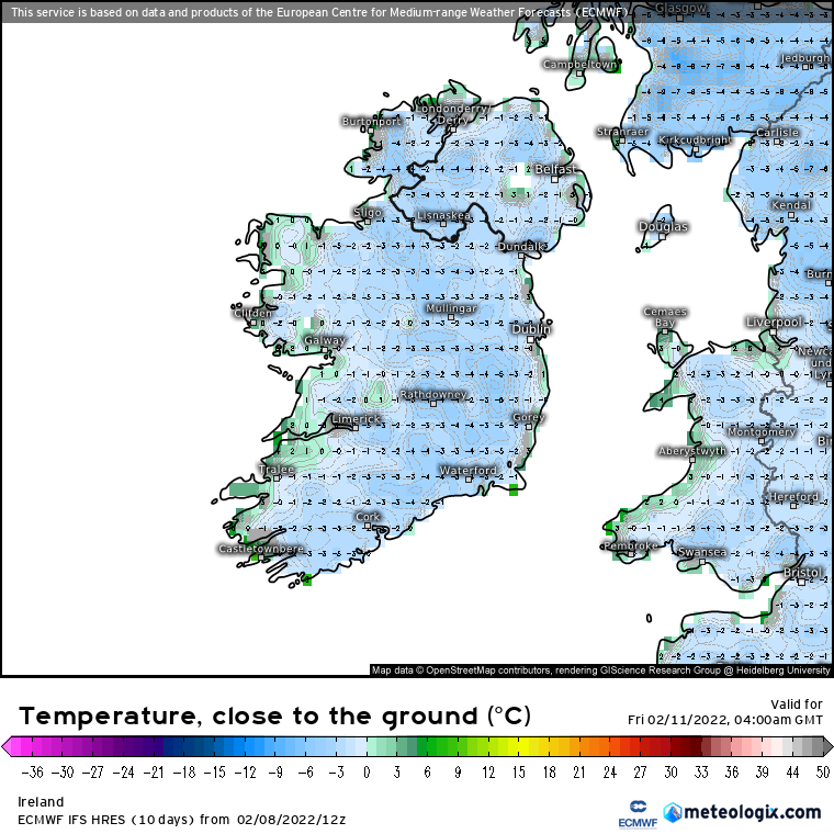
Turning cold with a widespread frost on Thursday night and Friday morning
FRIDAY
Starting off frosty on Friday morning for many especially across Ulster and Leinster with morning lows of around -4C at around dawn , Frost and ice will clear quickly in the morning as cloud moves in from the Atlantic later in the morning and over the afternoon with rain following for the afternoon and evening. Temperatures on Friday 5C to 7C. . Friday night will see outbreaks of rain across Ireland and it will be less cold.

WEEKEND
This weekend will be unsettled with some heavy rain expected places on Saturday. Sunday will be a showery day with the risk of some isolated thunderstorms in places. Some of the showers possibly of hail.


NEXT WEEK - STORMY OUTLOOK
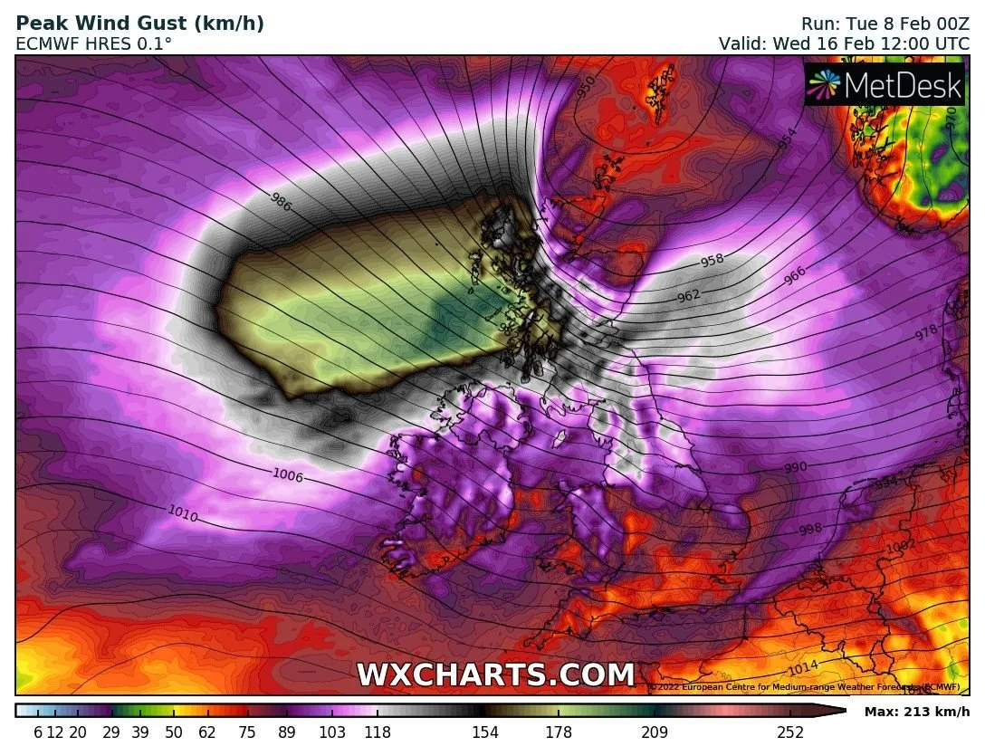
Next week it will remain unsettled across Ireland with wet and windy weather at times. From midweek into the end of the week there is a potential for very stormy weather. The latest Outlook from the European weather forecasting model ecmwf shows the potential for a possible strong wind storm around mid week onwards. At present the latest forecast shows the Jetstream strengthening across Ireland feeding low pressure systems close to the northwest and north of Ireland at the moment there is a lot of uncertainty with this and there's a lot of dynamics in play so it will be at least the end of this weekend before we have a better picture on this period but this will have to be closely watched . Make sure to stay tuned to the forecast over the coming days and through the weekend for updates on the potential very stormy conditions for next week.

The European model the past 48 hours showing a very strong wind storm possibly mid week next week

A very powerful jet stream next week feed lows across the Atlantic which would help intensify any low pressure systems or storms as they move close to Ireland.
Kenneth from the Donegal Weather Channel
LATEST NEWS


