
We could be set for a cold Christmas period and end to 2020

PART 2 CHRSITMAS WEATHER OUTLOOK - TREND COLDER WEATHER
UPDATE - 14TH DECEMBER 2020
We are now 10 days away until Christmas day and in the weather world this time of year the biggest question been asked by most will there be a white Christmas? Whats the chances of a white Christmas? Will it be cold?
We are looking at the trends coming up to the Christmas Period and what the forecast models show with 3 of the longer range models showing a change to the weather pattern a day or two before Christmas day.

In this update we will look at the GFS, ECMWF & GEM weather forecasting model and the trends the show over the coming 10 days .
GFS - American weather forecasting model
ECMWF - European weather forecast model
GEM - Canadian forecast model
UNSETTLED WEATHER
The trend over the coming 7 to 9 days days from all 3 forecast models is for unsettled weather with the risk of wet and windy weather at times. in that time frame the Jet stream is looking set to move close to Ireland bringing areas of low pressure across the Atlantic developing them close to Ireland.
The image below shows the strong jet moving over or close to Ireland at times over the coming days developing areas of low pressure as the move across the Atlantic.


SNOWFALL FOR CHRISTMAS?
It is yet to early call if there will be snow on Christmas eve or day but the trend of all 3 forecast models over the coming days is showing the weather turning colder over the Christmas period and remaining cold the closing days of 2020.
For example the GFS weather model shows a area of high pressure building across the Atlantic around Christmas eve and day also known as a blocking high which will keep the normal wet and windy weather at bay which can been seen on the below chart.

Higher pressure building in the Atlantic
This then leads to a cold northerly airflow to flood down from the polar regions with sharp frosts at nights but at this timeframe yet say if there is going to be some white stuff on the ground for Christmas its to early to say.

Colder air flooding down from the north around Christmas
The trend then from the GFS is for high pressure to bring in a much colder northeast to east airflow towards the end of 2020

Even colder air for the end of the year but a this range its uncertain
The Ensemble mean and spread from the ECMWF weather model is also going for high pressure build around the Christmas period bring colder weather
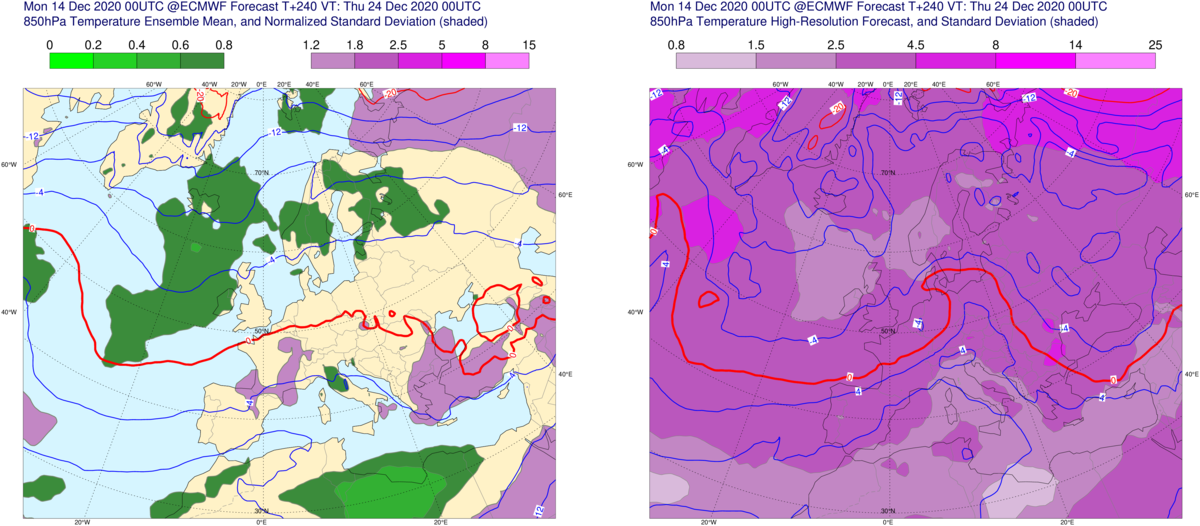
Colder air sitting over western Europe around Christmas
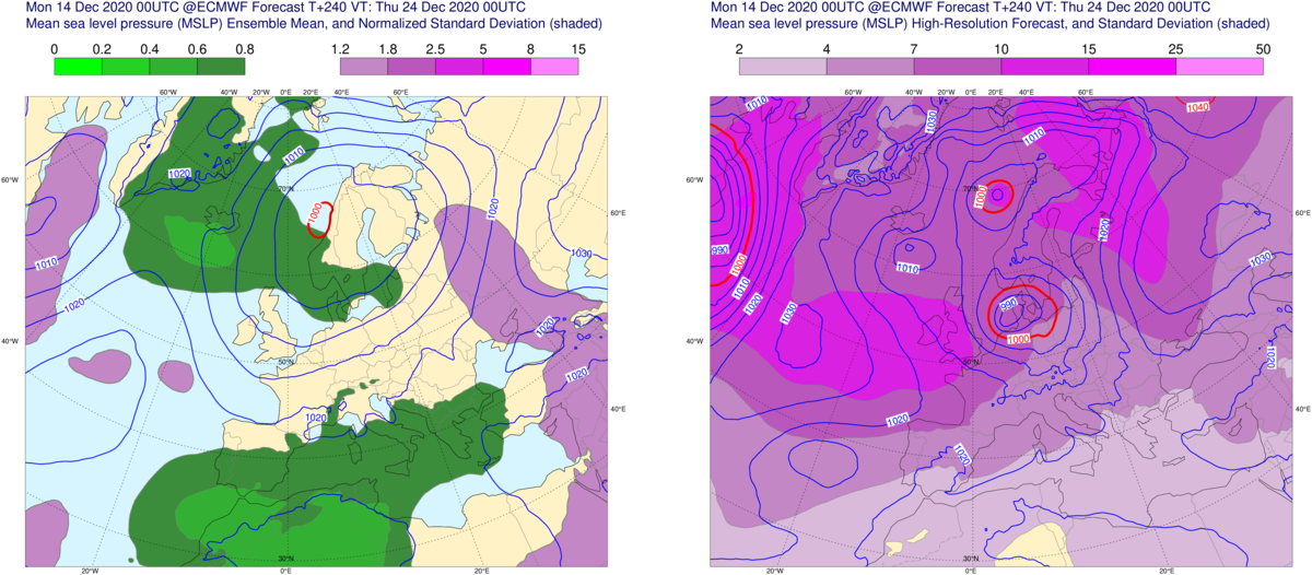
high pressure to the northeast and west bringing in a much colder northerly airflow Christmas eve
I will have another update at the end of this week Friday the 18th when we will be only a week away from Christmas. If anything out of the ordinary shows on the forecast models between now and Friday for Christmas is will update on that before the end of this week
Kenneth from the Donegal Weather Channel
You can find all the latest weather warnings and forecasts by downloading our app from the google play store by clicking below

LATEST NEWS


