
Wet and stormy weather overnight for some with a high risk of flooding

A deep low of the south of Ireland at present will move northwards up across the western half of Ireland tonight and Monday morning giving a period of strong winds across the southern and eastern half of Ireland. A Orange wind warning is in places for Cork but this warning is mainly to cover the risk of flooding which could occur at high tide on Tuesday night & Wednesday morning due to high seas and strong onshore winds, there is the risk of coastal flooding tonight. Winds will gust up to 70km/hr to 110k/hr across much of Leinster and Munster.

There will be less of a impact across Much of Ulster and Connacht with the center of the low moving up across the west of Ireland it will lose its intensity with gusts there between 40km/hr to 70km/hr. Across eastern and northern areas of Ulster along coastal areas wind will be a little stronger for a time Wednesday morning gusting up to 100km/hr possibly.
The reason for the area of low pressure is due to the Jet Stream will strengthen over Ireland during Tuesday. This Jetstream can steer surface low pressure systems towards Ireland and intensify them, depending on the location of the low relative to the Jetstream.

This Jetstream can steer surface low pressure systems towards Ireland and intensify them, depending on the location of the low relative to the Jetstream.

A secondary low pressure system is forecast to form in the Mid-Atlantic on Monday and track eastwards through Monday night and Tuesday morning, deepening steadily. There is then generally good agreement between forecast models that the system will track towards Ireland,

ECMWF forecast for position of low pressure system at 12UTC Tuesday 15th December.
Rainfall
A band of heavy rain is forecast to move into the southwest on Tuesday evening, extending across the country during Tuesday night. The rain is expected to clear from most areas on Wednesday morning, although the west coast could see further heavy rain through the morning. While the rain will be heavy, its progression should be quite quick. However, due to soils being saturated or waterlogged there will be a risk of flooding (see below for further comments on flood risks). Based on the latest forecast, 6-hour accumulations of 10 to 15mm are expected in parts of the southwest and west.
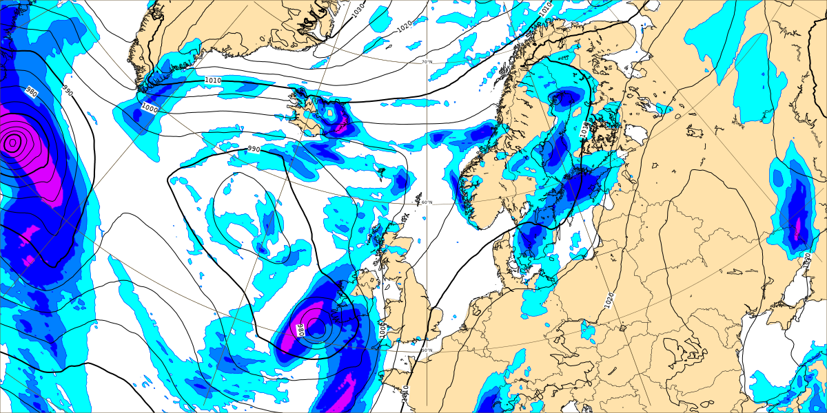
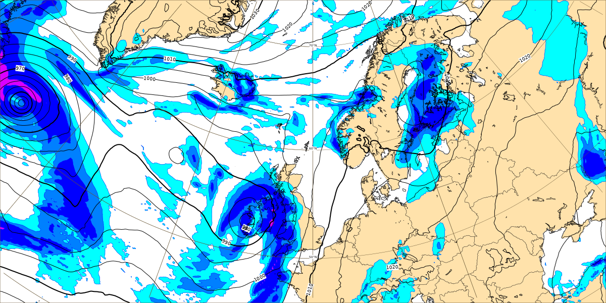
Below images show Rain and mean sea level pressure
High resolution forecast
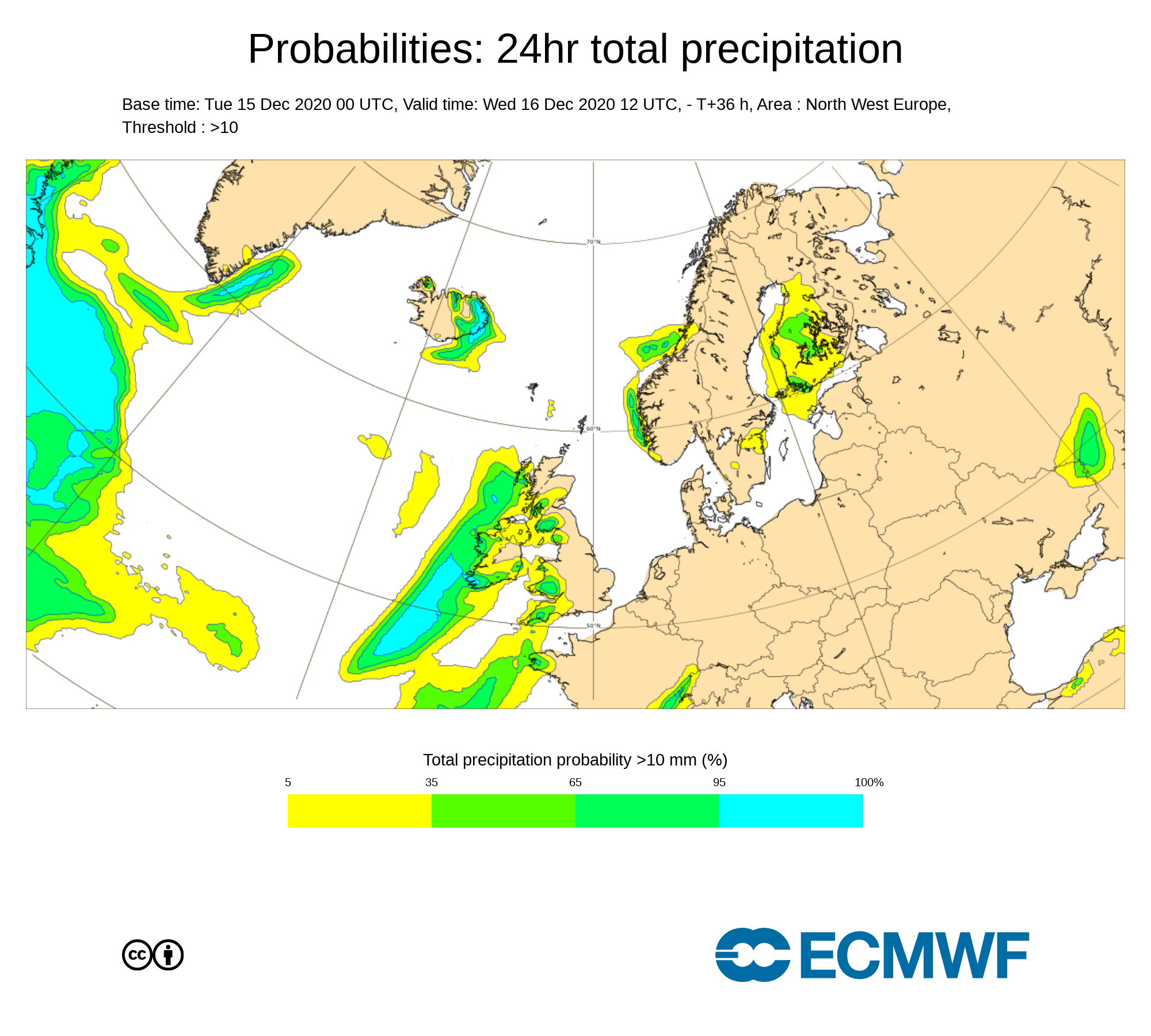
Probabilities: 24hr total precipitation
Coastal Flood Risk
We are in a period of Spring (High) Tides. The combination of Spring (High) Tides and very unsettled, potentially stormy, conditions associated with a depression on Tuesday/Wednesday, is likely to increase the risk of coastal flooding (spray overtopping and localised wave overtopping), especially in flood-prone areas along all Irish coasts (particularly when coincident with High Tides and onshore winds).
Please see below the approximate Spring High Tide times below for Tuesday and Wednesday:
Tuesday 15th December 2020
West and South coasts: 04:30 – 07:00 & 17:00 – 19:30 (early morning and evening)
East coast: 10:00 – 12:00 & 22:30 – 00:00 (late morning and late evening)
Wednesday 16th December 2020
West and South coasts: 05:30 – 08:00 & 18:00 – 20:30 (early morning and evening)
East coast: 11:00 – 12:30 & 23:30 – 01:00 (late morning/midday and late evening)
River Flood Risk
Soils are mostly waterlogged countrywide, or at least in saturated conditions. Rivers are already elevated in the western half of the country, in response to appreciable rainfall over the last week or so. Over the coming days, multiple separate spells of rain (whilst individually these may not reach rainfall warning criteria) will further exacerbate the flood risk. Localised flooding is expected in the western half of the country over the next week.
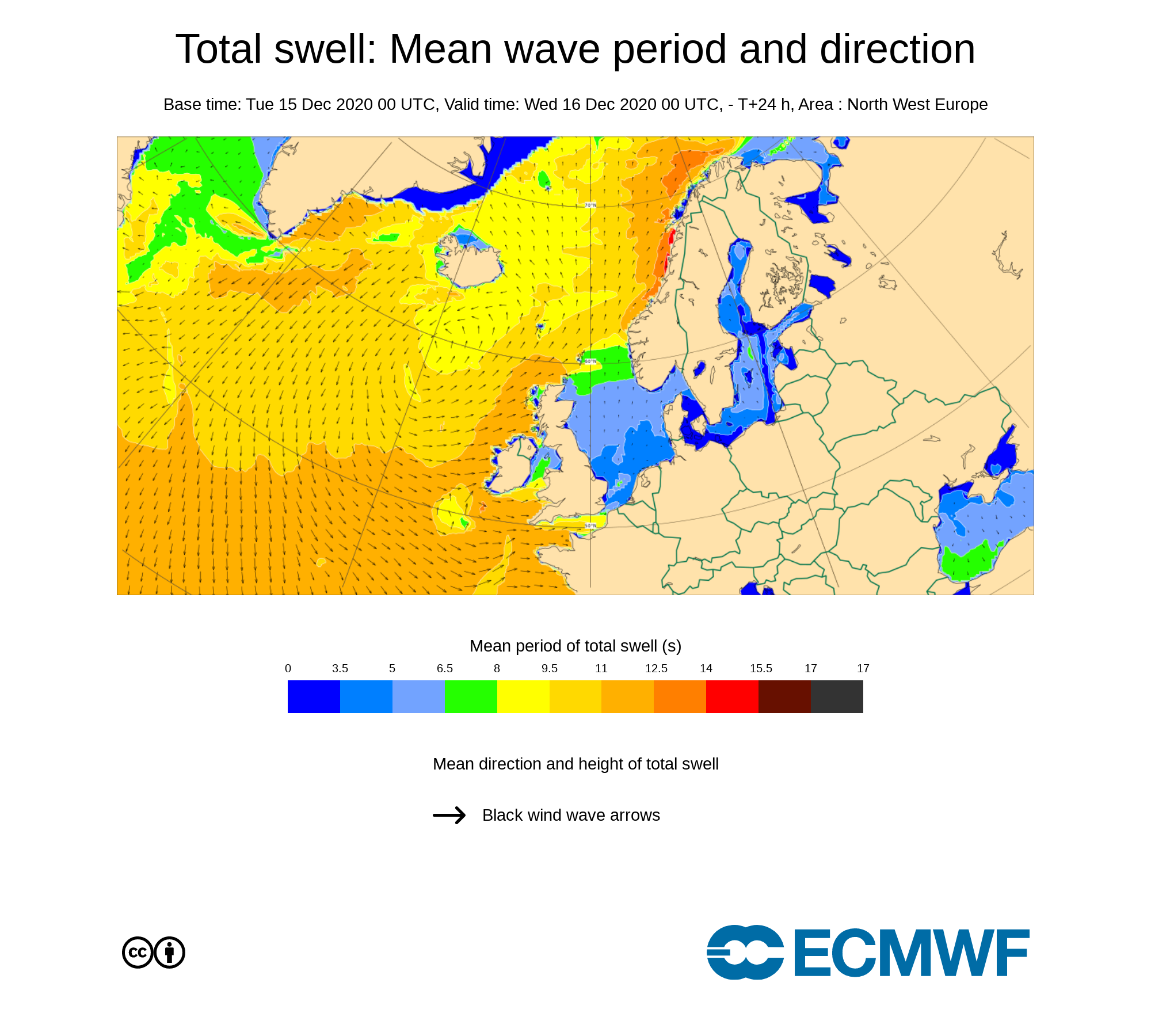
Total swell: Mean wave period and direction
High resolution forecast
You can find all the latest weather warnings and forecasts by downloading our app from the google play store by clicking below

LATEST NEWS


