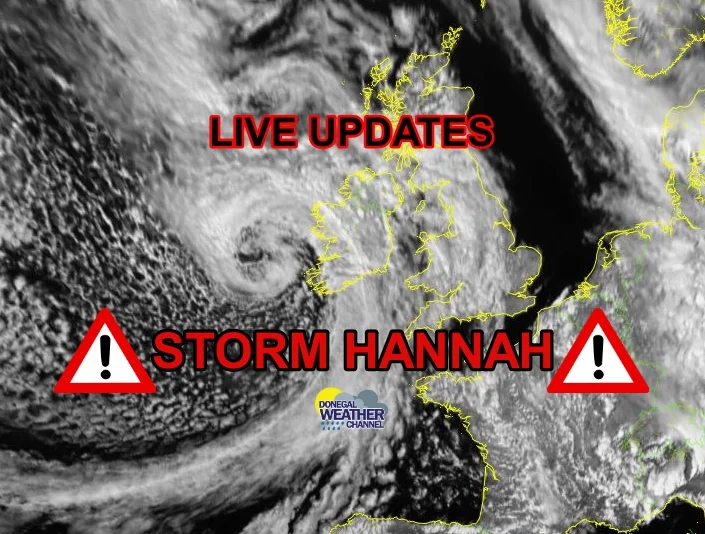
LATEST UPDATE ON STORM CALLUM - STRONG WINDS AND HEAVY RAIN FROM TONIGHT
Thursday night Storm Callum - 9pm/ 10pm
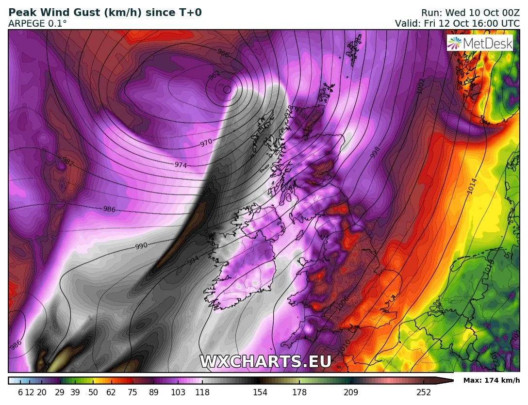
Winds on Thursday night will be strong and south to Southeasterly in direction with severe and damaging gusts of between 100km/hr to 130km/hr across coastal areas of the west and south of Ireland with strong winds also across inland areas. See the warnings page for the latest weather warnings. There will be further falls of rain on Thursday night across western and southern county’s and this along with strong and potentially damaging gusts could lead to dangerous driving conditions out and about. The public are advised to travel with caution and don’t make any unnecessary journeys.
Thursday night into early Friday morning as storm Callum moves up off the west coast of Ireland it will bring strong and damaging gusts along coastal county’s of Donegal, Antrim, Derry, Down, Galway, Mayo, Sligo, Clare, Dublin, Louth, Wexford, Wicklow, Meath Waterford, Cork and Kerry where gusts of between 100km/hr to 130km/hr will be possible. There is the chance that gusts may exceed 130km/hr for time over the early morning along some southwestern, western and northwestern coastal county’s. Winds across the rest of Ireland inland will also be strong with gusts of between 90km/hr to 110km/hr.
Winds will ease for a time on Friday morning but remain strong across Ireland. Later in the morning at around 9am/10am and over the afternoon winds will strengthen again across western and northwestern county’s with gusts along coastal county’s strongest and possibly reaching 130km/hr again.
On Friday Lunchtime and over the early afternoon winds will also strengthen again along the south, southeast and east with severe and damaging gusts along coastal county’s there between 100km/hr to 130km/hr. These will pass in a short period and should clear at around 3pm Friday.
Continues below
Late Thursday night and Early Friday morning rain will spread from the southwest moving northeastwards across Ireland with heavy falls in places and the risk of flooding nationwide, with strong and potentially damaging gust could lead to dangerous driving conditions out and about over Friday. The public are advise to travel with caution and don’t make any unnecessary journeys. Rain will clear to the northeast later Friday afternoon and evening.
Another spell of rain will move into the south and southeast on Friday night with the risk of spot flooding.
The public are advised to stay away from coastal walk ways, headlands and piers as strong winds combined with spring tides and a storm surge will lead to coastal flooding and danger to life.
Power outage can be expected on Thursday night and on Friday with the risk of trees also been uprooted. There also will be the risk to structural damage to building under the weather warnings periods. For the latest warnings click here .
Flight delays and ferry sailing are also likely to be effected on Friday.


